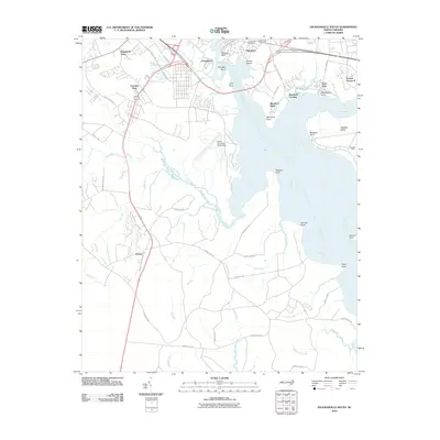
2010 Map of Jacksonville South
USGS Topo · Published 2010About this map
The expansive grounds of Camp Lejeune dominate this coastal landscape south of Jacksonville, where the New River meets a network of tidal creeks and marshes. The map reveals the specialized military infrastructure of the early 21st century, including the Peters Point Field Glider Base situated along the river's western bank. Residential communities such as Bayshore, Springdale Acres, and Georgetown flank the northern edge, while the south is characterized by the structured grid of military housing at Tarawa Terrace II and the Knox Area. This survey provides a precise record of the shoreline and maritime landmarks, from Momford Landing to the numerous points like Montford Point and Hadnot Point that define the river's winding path. To the west, the settlement of Verona sits along the rail corridor, surrounded by the drainage basins of Southwest Creek and Hicks Run.
Find a feature on this map
54 named features on this map. Tap any name to fly to it.
Don’t see what you’re looking for? This feature index may not catch every label — zoom into the map to look around manually.
Map Details
Editions of this 2010 Jacksonville South Map
This is the sole edition of this map. No revisions or reprints were ever made.
Other maps of this area

1943 · Jacksonville
USGS Topo · 1:62,500

1948 · Maple Hill
USGS Topo · 1:62,500

1948 · New River
USGS Topo · 1:62,500

1948 · Richlands
USGS Topo · 1:62,500

1952 · Camp Lejeune
USGS Topo · 1:24,000

1952 · Jacksonville South
USGS Topo · 1:24,000

1952 · New River Inlet
USGS Topo · 1:24,000

1952 · Sneads Ferry
USGS Topo · 1:24,000

1953 · Beaufort
USGS Topo · 1:250,000

1954 · Beaufort
USGS Topo · 1:250,000
Featured Places
- Jacksonville, NC
- Paradise Park, NC
- Utopia Mobile Home Park, NC
- Plum Point Estates, NC
- Springdale Acres, NC