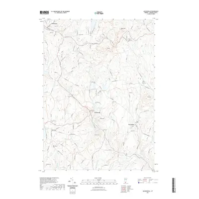
2021 Map of Jacksonville
USGS Topo · Published 2021About this map
The village of Jacksonville serves as a focal point in this southern Vermont landscape, situated near the confluence of the North River and the waters flowing from Jacksonville Pond. The area is defined by its numerous small burial grounds, which offer significant value for genealogical research, including the Old Hogback - West Marlboro Cem and the Brigham Young Memorial Cem near Sadawga Lake. The road network, including the historic Molly Stark Trl, connects these high-elevation settlements across terrain marked by Hogback Mtn and Mt Olga. To the east, West Halifax sits tucked along the Green River, while the northern portion of the map includes the edge of Wilmington. Numerous water bodies such as Spruce Lake, Ryder Pond, and Laurel Lake are distributed across the hills, linked by a web of brooks including Beaver Brook and Sprague Brook.
Find a feature on this map
128 named features on this map. Tap any name to fly to it.
Don’t see what you’re looking for? This feature index may not catch every label — zoom into the map to look around manually.
Map Details
Editions of this 2021 Jacksonville Map
This is the sole edition of this map. No revisions or reprints were ever made.
Other maps of this area

1886 · Hawley
USGS Topo · 1:62,500

1889 · Wilmington
USGS Topo · 1:62,500

1890 · Hawley
USGS Topo · 1:62,500

1890 · Greenfield
USGS Topo · 1:62,500

1891 · Wilmington
USGS Topo · 1:62,500

1891 · Brattleboro
USGS Topo · 1:62,500

1893 · Brattleboro
USGS Topo · 1:62,500

1894 · Greenfield
USGS Topo · 1:62,500

1894 · Hawley
USGS Topo · 1:62,500

1899 · Wilmington
USGS Topo · 1:62,500