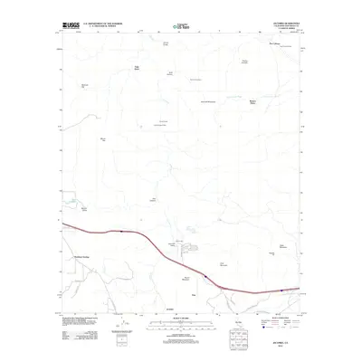
2012 Map of Jacumba
USGS Topo · Published 2012About this map
The Jacumba Mountains define this high desert border region, where early 21st-century infrastructure follows the paths of 20th-century pioneers. The settlement of Jacumba sits near the southern edge of the sheet, while the remnant paths of Old Highway 80 and several critical rail sidings trace the challenging landscape. Significant engineering is evident along the Carrizo Gorge, including Tunnel Fifteen Spur and Carrizo Gorge Siding, markers of the San Diego and Arizona Railway heritage. From the McCain Valley in the west to Dos Cabezas in the northeast, the map reveals a terrain punctuated by desert springs like Camp Sizzle Spring and prominent peaks such as Mount Tule and Gray Mountain. These landmarks provided essential navigation and water for travelers crossing between the Jacumba Valley and the deeper desert reaches.
Find a feature on this map
35 named features on this map. Tap any name to fly to it.
Don’t see what you’re looking for? This feature index may not catch every label — zoom into the map to look around manually.
Map Details
Editions of this 2012 Jacumba Map
This is the sole edition of this map. No revisions or reprints were ever made.
Other maps of this area

1931 · Carrizo
USGS Topo · 1:125,000

1939 · Campo
USGS Topo · 1:62,500

1939 · Jacumba
USGS Topo · 1:62,500

1942 · Campo
USGS Topo · 1:62,500

1942 · Carrizo Mtn
USGS Topo · 1:62,500

1942 · Jacumba
USGS Topo · 1:62,500

1942 · Cuyapaipe
USGS Topo · 1:62,500

1950 · San Diego
USGS Topo · 1:250,000

1954 · San Diego
USGS Topo · 1:250,000

1955 · San Diego
USGS Topo · 1:250,000