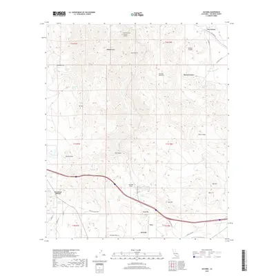
2018 Map of Jacumba
USGS Topo · Published 2018About this map
Jacumba and the neighboring settlement of Bankhead Springs anchor this corner of San Diego County, situated along the international border in a landscape defined by significant elevation changes and desert springs. The map documents a complex network of water sources vital to life in this arid region, including Arsenic Spring, Dos Cabezas Spring, and Iron Spring. The terrain is marked by prominent landforms such as the Jacumba Mountains and the dramatic Carrizo Gorge, while the inclusion of the Mortero Palms and Palm Grove highlights the unique botanical pockets found within the canyons. In the northern reaches, the map identifies Dos Cabezas and the expansive McCain Valley, illustrating the varied topography from flat lakebeds like Tule Lake to the high peaks of Mt Tule and Gray Mtn.
Find a feature on this map
43 named features on this map. Tap any name to fly to it.
Don’t see what you’re looking for? This feature index may not catch every label — zoom into the map to look around manually.
Map Details
Editions of this 2018 Jacumba Map
This is the sole edition of this map. No revisions or reprints were ever made.
Other maps of this area

1931 · Carrizo
USGS Topo · 1:125,000

1939 · Campo
USGS Topo · 1:62,500

1939 · Jacumba
USGS Topo · 1:62,500

1942 · Campo
USGS Topo · 1:62,500

1942 · Carrizo Mtn
USGS Topo · 1:62,500

1942 · Jacumba
USGS Topo · 1:62,500

1942 · Cuyapaipe
USGS Topo · 1:62,500

1950 · San Diego
USGS Topo · 1:250,000

1954 · San Diego
USGS Topo · 1:250,000

1955 · San Diego
USGS Topo · 1:250,000