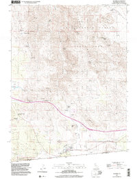
1997 Map of Jacumba
USGS Topo · Published 2003About this map
The high desert borderlands near Jacumba are defined by the convergence of steep mountain ranges and the international boundary. This area, largely preserved within Anza-Borrego Desert State Park, illustrates the difficult engineering required for transportation through the Carrizo Gorge. The San Diego & Arizona Eastern RR winds through the canyons, passing the Goat Canyon area with its notable topography. Human settlement is concentrated in the southern portion of the map, where the Airport and local landmarks like Bankhead Springs and Dos Cabezas sit near the Mexico border. Water remains a critical and named resource in this arid landscape, evidenced by numerous locations such as Arsenic Spring, Iron Spring, and Tule Lake. The mapping of varied terrain from Gray Mountain to the In-Ko-Pah Mountains highlights the geologic complexity that historically challenged early rail and road development.
Find a feature on this map
65 named features on this map. Tap any name to fly to it.
Don’t see what you’re looking for? This feature index may not catch every label — zoom into the map to look around manually.
Map Details
Editions of this 1997 Jacumba Map
This is the sole edition of this map. No revisions or reprints were ever made.
Other maps of this area

1931 · Carrizo
USGS Topo · 1:125,000

1939 · Campo
USGS Topo · 1:62,500

1939 · Jacumba
USGS Topo · 1:62,500

1942 · Campo
USGS Topo · 1:62,500

1942 · Carrizo Mtn
USGS Topo · 1:62,500

1942 · Jacumba
USGS Topo · 1:62,500

1942 · Cuyapaipe
USGS Topo · 1:62,500

1950 · San Diego
USGS Topo · 1:250,000

1954 · San Diego
USGS Topo · 1:250,000

1955 · San Diego
USGS Topo · 1:250,000