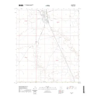
2023 Map of Jal
USGS Topo · Published 2023About this map
Jal anchors this corner of Southeast New Mexico, where a grid of residential streets like S Alameda St and W Wyoming Ave gives way to the industrial and ranching landscape of the Permian Basin. The town's layout reflects a history of energy development, evidenced by specialized thoroughfares such as Tank Farm Ln and the proximity of Jal Cem on the outskirts. To the south, the smaller settlement of Bennett is reached via Bennettville Rd, situated near the wide, open expanse of Toboso Flats. This 2023 survey illustrates the modern road network required to service the surrounding oil and gas fields, with long, straight routes like Frying Pan Rd and Willis Rd cutting across the high desert terrain. The map provides a clear look at the intersection of local habitation and the expansive infrastructure typical of Lea County.
Find a feature on this map
40 named features on this map. Tap any name to fly to it.
Don’t see what you’re looking for? This feature index may not catch every label — zoom into the map to look around manually.
Map Details
Editions of this 2023 Jal Map
This is the sole edition of this map. No revisions or reprints were ever made.
Other maps of this area

1954 · Hobbs
USGS Topo · 1:250,000

1954 · Pecos
USGS Topo · 1:250,000

1957 · Pecos
USGS Topo · 1:250,000

1958 · Hobbs
USGS Topo · 1:250,000

1969 · Jal NE
USGS Topo · 1:24,000

1969 · Jal NW
USGS Topo · 1:24,000

1969 · Jal
USGS Topo · 1:24,000

1969 · Jal SE
USGS Topo · 1:24,000

1970 · Cheyenne Draw
USGS Topo · 1:24,000

1970 · Vesrue
USGS Topo · 1:24,000