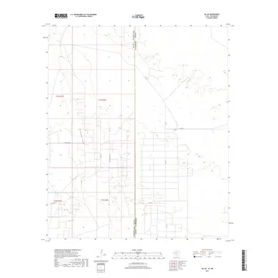
2019 Map of Jal NE
USGS Topo · Published 2019About this map
Monument Draw cuts through this arid landscape on the border of New Mexico and Texas, a defining geographic feature in an area marked by extensive land surveying and resource development. The terrain is divided by the Texas-New Mexico state line, which separates Lea County from Andrews County. This 2019 survey illustrates the systematic grid of township and range divisions, including sections of t24s r37e, t24s r38e, and t25s r38e. A network of local roads and corridors, such as Dollarhide Rd, Saga Ln, and several numbered routes like SW 9751, provides access across the flat plains. The map's detail focuses on the practical infrastructure of the Permian Basin region, showing the density of trails and access points required for the local industrial and ranching operations that characterize this borderland.
Find a feature on this map
14 named features on this map. Tap any name to fly to it.
Don’t see what you’re looking for? This feature index may not catch every label — zoom into the map to look around manually.
Map Details
Editions of this 2019 Jal NE Map
This is the sole edition of this map. No revisions or reprints were ever made.
Other maps of this area

1954 · Hobbs
USGS Topo · 1:250,000

1958 · Hobbs
USGS Topo · 1:250,000

1969 · Jal NE
USGS Topo · 1:24,000

1969 · Eunice SE
USGS Topo · 1:24,000

1969 · Jal NW
USGS Topo · 1:24,000

1969 · Jal
USGS Topo · 1:24,000

1969 · Rattlesnake Canyon
USGS Topo · 1:24,000

1969 · Jal SE
USGS Topo · 1:24,000

1971 · Figure Seven Ranch
USGS Topo · 1:24,000

1971 · Frankel City SW
USGS Topo · 1:24,000