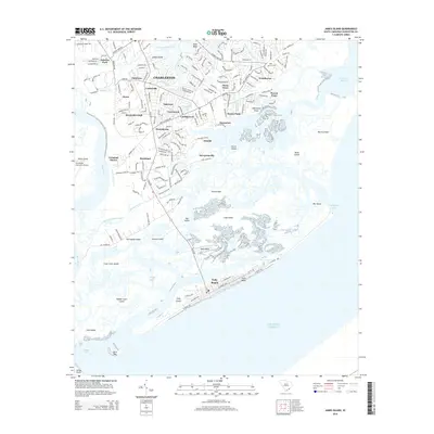
2014 Map of James Island
USGS Topo · Published 2014About this map
James Island and the coastal barrier islands south of Charleston define this 2014 survey, illustrating the modern expansion of suburban residential neighborhoods against a backdrop of historic coastal geography. The landscape is characterized by a complex network of tidal waterways such as James Island Creek, Simpson Cr, and Secessionville Cr, which separate the mainland from islands like Morris Island and Folly Island. Residential enclaves such as Landsdowne, Secessionville, and Grimball Shores are shown in detail, integrated into the marshes and inlets that lead to the Atlantic Ocean.
Find a feature on this map
182 named features on this map. Tap any name to fly to it.
Don’t see what you’re looking for? This feature index may not catch every label — zoom into the map to look around manually.
Map Details
Editions of this 2014 James Island Map
This is the sole edition of this map. No revisions or reprints were ever made.
Other maps of this area

1918 · Kiawah Island
USGS Topo · 1:21,120

1919 · Johns Island
USGS Topo · 1:21,120

1919 · The Jetties
USGS Topo · 1:21,120

1919 · Wadmelaw Island
USGS Topo · 1:62,500

1919 · Charleston
USGS Topo · 1:21,120

1919 · James Island
USGS Topo · 1:21,120

1919 · Fort Moultrie
USGS Topo · 1:21,120

1919 · Legareville
USGS Topo · 1:21,120

1920 · Ravenels
USGS Topo · 1:62,500

1943 · Fort Moultrie
USGS Topo · 1:24,000