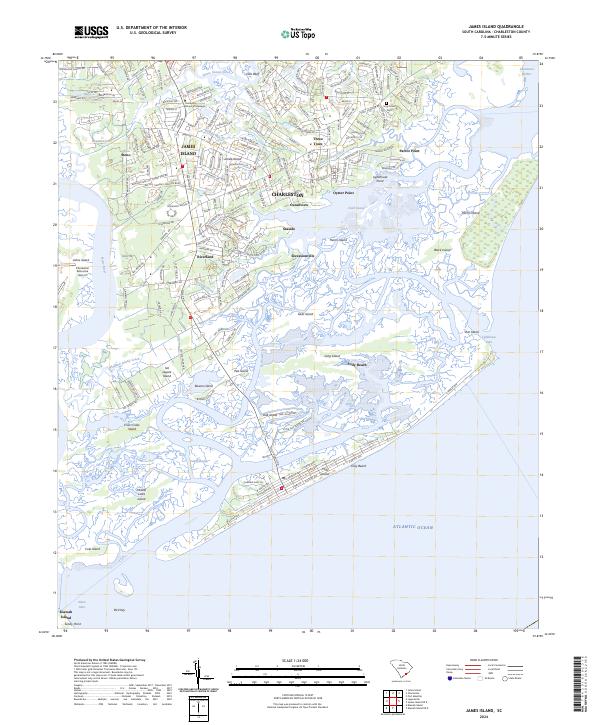
2024 Map of James Island
USGS Topo · Published 2024About this map
James Island and its intricate network of tidal creeks and marshlands define this coastal area just south of Charleston. The landscape is a mosaic of established residential settlements like Dills Bluff, Oceanview, and Seaside, interspersed with historic sites such as Secessionville. This 2024 survey captures the modern road network, including the vital artery of Folly Rd which connects the mainland to the beach communities.
Find a feature on this map
189 named features on this map. Tap any name to fly to it.
Don’t see what you’re looking for? This feature index may not catch every label — zoom into the map to look around manually.
Map Details
Editions of this 2024 James Island Map
This is the sole edition of this map. No revisions or reprints were ever made.
Other maps of this area

1918 · Kiawah Island
USGS Topo · 1:21,120

1919 · Johns Island
USGS Topo · 1:21,120

1919 · The Jetties
USGS Topo · 1:21,120

1919 · Wadmelaw Island
USGS Topo · 1:62,500

1919 · Charleston
USGS Topo · 1:21,120

1919 · James Island
USGS Topo · 1:21,120

1919 · Fort Moultrie
USGS Topo · 1:21,120

1919 · Legareville
USGS Topo · 1:21,120

1920 · Ravenels
USGS Topo · 1:62,500

1943 · Fort Moultrie
USGS Topo · 1:24,000