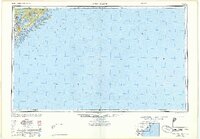
1948 Map of James Island
USGS Topo · Published 1948About this map
Fort Sumter and Fort Moultrie stand as sentinel landmarks guarding the harbor entrance in this post-war coastal survey. The map illustrates the strategic geography of Charleston, where the Ashley River and Cooper River converge, highlighting the extensive Naval Reservation and maritime infrastructure of the era. The intricate network of sea islands, including James Island, Sullivans Island, and Morris Island, is shown before the major modern development of the late 20th century. To the north, the protected landscape of the Francis Marion National Forest meets the coastal marshes of Bull Bay. Researchers can trace the Seaboard rail lines and the early footprint of North Charleston, as well as small landings like Redbank Landing and the aviation interest at Carolina Skyways.
Find a feature on this map
41 named features on this map. Tap any name to fly to it.
Don’t see what you’re looking for? This feature index may not catch every label — zoom into the map to look around manually.
Map Details
Editions of this 1948 James Island Map
2 editions found

Other maps of this area

1918 · Kiawah Island
USGS Topo · 1:21,120

1919 · Ladson
USGS Topo · 1:21,120

1919 · Johns Island
USGS Topo · 1:21,120

1919 · Summerville
USGS Topo · 1:48,000

1919 · The Jetties
USGS Topo · 1:21,120

1919 · Capers Island
USGS Topo · 1:21,120

1919 · Wadmelaw Island
USGS Topo · 1:62,500

1919 · Wando
USGS Topo · 1:21,120

1919 · Cordesville
USGS Topo · 1:48,000

1919 · Melgrove
USGS Topo · 1:21,120