
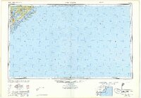
1948 Map of James Island
USGS Topo · Published 1948About this map
Charleston and its surrounding coastal islands are depicted here just after the war, showing the strategic maritime landscape of the South Carolina coast. The confluence of the Cooper River, Wando River, and Ashley River anchors the peninsula, with the Naval Reservation and significant defense sites like Fort Sumter and Fort Moultrie marking the harbor entrance. This 1948 compilation integrates data from wartime surveys and aerial photography, capturing the layout of coastal settlements before the era of intensive beachfront development.
Find a feature on this map
31 named features on this map. Tap any name to fly to it.
Don’t see what you’re looking for? This feature index may not catch every label — zoom into the map to look around manually.
Map Details
Editions of this 1948 James Island Map
2 editions found
Other maps of this area

1918 · Kiawah Island
USGS Topo · 1:21,120

1919 · Ladson
USGS Topo · 1:21,120

1919 · Johns Island
USGS Topo · 1:21,120

1919 · Summerville
USGS Topo · 1:48,000

1919 · The Jetties
USGS Topo · 1:21,120

1919 · Capers Island
USGS Topo · 1:21,120

1919 · Wadmelaw Island
USGS Topo · 1:62,500

1919 · Wando
USGS Topo · 1:21,120

1919 · Cordesville
USGS Topo · 1:48,000

1919 · Melgrove
USGS Topo · 1:21,120