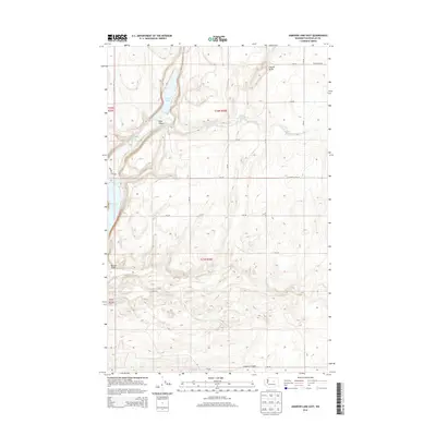
2014 Map of Jameson Lake East
USGS Topo · Published 2014About this map
Grimes Lake and its surrounding basaltic landscape define this portion of Douglas County, where the desert floor is carved by deep coulees and seasonal drainages. The map reveals a cluster of interior basins including Bennett Lake, Twin Lakes, and Fisher Lakes, illustrating the unique hydrology of the Moses Coulee region. Significant geological features such as Chester Butte rise above the undulating terrain, while deep incisions like Long Canyon and Sulphur Canyon show the erosional forces that have shaped the land over millennia.
Find a feature on this map
28 named features on this map. Tap any name to fly to it.
Don’t see what you’re looking for? This feature index may not catch every label — zoom into the map to look around manually.
Map Details
Editions of this 2014 Jameson Lake East Map
This is the sole edition of this map. No revisions or reprints were ever made.
Other maps of this area

1953 · Ritzville
USGS Topo · 1:250,000

1959 · Ritzville
USGS Topo · 1:250,000

1965 · Ritzville
USGS Topo · 1:250,000

1965 · Jameson Lake SW
USGS Topo · 1:24,000

1965 · Jameson Lake SE
USGS Topo · 1:24,000

1965 · St. Andrews
USGS Topo · 1:24,000

1965 · Jameson Lake West
USGS Topo · 1:24,000

1965 · Jameson Lake East
USGS Topo · 1:24,000
1965 · Park Lake
USGS Topo · 1:24,000
1968 · Barnes Butte
USGS Topo · 1:24,000