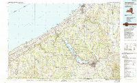
1986 Map of Jamestown
USGS Topo · Published 1989About this map
Chautauqua Lake anchors this part of western New York, serving as a central geographic and cultural axis between the industrial shoreline of Lake Erie and the rural hills of the Southern Tier. The map shows the established cultural footprint of the Chautauqua Institution along the lake's western shore, contrasting with the commercial centers of Jamestown and Dunkirk. Transportation networks dominate the landscape, from the heavy transit corridor of the New York State Thruway and Conrail lines along the lake plain to the winding routes through the Flag Creek Valley. Local landmarks like the Dunkirk Lighthouse and Barcelona Lighthouse mark the historic maritime edge, while higher elevations are defined by prominent points like Luce Hill and Boutwell Hill, highlighting the transition from the Erie plain to the Allegheny Plateau.
Find a feature on this map
283 named features on this map. Tap any name to fly to it.
Don’t see what you’re looking for? This feature index may not catch every label — zoom into the map to look around manually.
Map Details
Editions of this 1986 Jamestown Map
2 editions found
Other maps of this area

1899 · Westfield
USGS Topo · 1:62,500

1899 · Silver Creek
USGS Topo · 1:62,500

1899 · Erie
USGS Topo · 1:62,500

1900 · Dunkirk
USGS Topo · 1:62,500

1900 · Erie
USGS Topo · 1:62,500

1900 · Cherry Creek
USGS Topo · 1:62,500

1904 · Chautaqua
USGS Topo · 1:62,500

1905 · Clymer
USGS Topo · 1:62,500

1905 · Jamestown
USGS Topo · 1:62,500

1905 · Eden
USGS Topo · 1:62,500