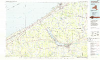
1986 Map of Jamestown
USGS Topo · Published 1986About this map
Chautauqua Lake anchors this 1980s landscape, serving as a cultural and geographic center for the surrounding settlements. The famed Chautauqua Institution stands on its western shore, while the county seat of Mayville sits at its northern tip. To the southeast, the urban center of Jamestown is shown alongside industrial rail corridors like Conrail and the Norfolk and Western Railway. This planimetric study documents the region's transition from the developed Lake Erie shoreline at Dunkirk and North East to the interior highlands and agricultural valleys.
Find a feature on this map
101 named features on this map. Tap any name to fly to it.
Don’t see what you’re looking for? This feature index may not catch every label — zoom into the map to look around manually.
Map Details
Editions of this 1986 Jamestown Map
2 editions found
Other maps of this area

1899 · Westfield
USGS Topo · 1:62,500

1899 · Silver Creek
USGS Topo · 1:62,500

1899 · Erie
USGS Topo · 1:62,500

1900 · Dunkirk
USGS Topo · 1:62,500

1900 · Erie
USGS Topo · 1:62,500

1900 · Cherry Creek
USGS Topo · 1:62,500

1904 · Chautaqua
USGS Topo · 1:62,500

1905 · Clymer
USGS Topo · 1:62,500

1905 · Jamestown
USGS Topo · 1:62,500

1905 · Eden
USGS Topo · 1:62,500