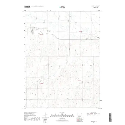
2018 Map of Jamestown
USGS Topo · Published 2018About this map
Jamestown serves as the primary center of activity in this Cloud County landscape, where the local street grid including Elm St, Spruce St, and Walnut St defines the town's core. The surrounding countryside is characterized by its drainage into the Buffalo Creek and Whites Cr systems, punctuated by a significant Salt Marsh to the northeast. This 2018 survey captures a well-established rural infrastructure of county roads, such as Shell Rd and Rock Rd, which connect the settlement to outlying areas like Yuma. For those tracing local heritage, the map identifies specific points of historical continuity including Fairview Cem and West Summit Cem, as well as the town's Po, situated along the grid near 4th St.
Find a feature on this map
47 named features on this map. Tap any name to fly to it.
Don’t see what you’re looking for? This feature index may not catch every label — zoom into the map to look around manually.
Map Details
Editions of this 2018 Jamestown Map
This is the sole edition of this map. No revisions or reprints were ever made.
Other maps of this area

1892 · Concordia
USGS Topo · 1:125,000

1892 · Minneapolis
USGS Topo · 1:125,000

1953 · Glasco NE
USGS Topo · 1:24,000

1953 · Simpson
USGS Topo · 1:24,000

1955 · Manhattan
USGS Topo · 1:250,000

1956 · Manhattan
USGS Topo · 1:250,000

1957 · Manhattan
USGS Topo · 1:250,000
1965 · Aurora NW
USGS Topo · 1:24,000

1965 · Concordia NW
USGS Topo · 1:24,000
1965 · Concordia
USGS Topo · 1:24,000