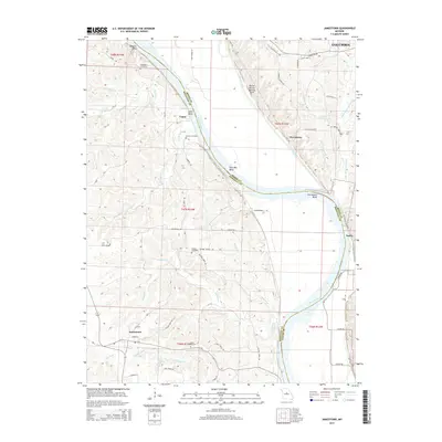
2015 Map of Jamestown
USGS Topo · Published 2015About this map
The Missouri River carves a winding path through the central Missouri landscape, defining the boundary between Moniteau and Boone counties. Along its banks, the river's historical shifts are visible in a series of dramatic curves including McBaine Bend, Lupus Bend, Plow Boy Bend, and Providence Bend. This area shows a transition from the river bottomlands to the dissected uplands, where features like the Roche Percée Natural Arch and Perche Creek punctuate the terrain.
Find a feature on this map
65 named features on this map. Tap any name to fly to it.
Don’t see what you’re looking for? This feature index may not catch every label — zoom into the map to look around manually.
Map Details
Editions of this 2015 Jamestown Map
This is the sole edition of this map. No revisions or reprints were ever made.
Other maps of this area

1886 · Jefferson City
USGS Topo · 1:125,000

1888 · Boonville
USGS Topo · 1:125,000

1894 · Jefferson City
USGS Topo · 1:125,000

1935 · Columbia
USGS Topo · 1:24,000

1940 · Columbia
USGS Topo · 1:24,000

1947 · Jefferson City
USGS Topo · 1:250,000

1948 · Centertown
USGS Topo · 1:62,500
1948 · Columbia
USGS Topo · 1:24,000

1948 · Columbia
USGS Topo · 1:62,500
1949 · Centertown
USGS Topo · 1:62,500