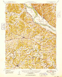
1949 Map of Centertown
USGS Topo · Published 1949About this map
The Missouri River bisects this landscape, creating a distinct boundary between the river valley flats and the dissected uplands of Moniteau and Cole Counties. The river's influence is evident at Fox Island and the riverside settlements of Marion, Wilton, and Claysville. Inland, the terrain is defined by a dense network of country schools and churches that served the rural population in the late 1940s, including Lone Star Sch, Bonds Chapel, and Eldorado Sch.
Find a feature on this map
93 named features on this map. Tap any name to fly to it.
Don’t see what you’re looking for? This feature index may not catch every label — zoom into the map to look around manually.
Map Details
Editions of this 1949 Centertown Map
This is the sole edition of this map. No revisions or reprints were ever made.
Other maps of this area

1886 · Jefferson City
USGS Topo · 1:125,000

1888 · Versailles
USGS Topo · 1:125,000

1888 · Tuscumbia
USGS Topo · 1:125,000

1888 · Boonville
USGS Topo · 1:125,000

1893 · Versailles
USGS Topo · 1:125,000

1894 · Tuscumbia
USGS Topo · 1:125,000

1894 · Jefferson City
USGS Topo · 1:125,000

1904 · Eldon
USGS Topo · 1:62,500

1939 · Jefferson City
USGS Topo · 1:24,000

1939 · Jefferson City
USGS Topo · 1:62,500