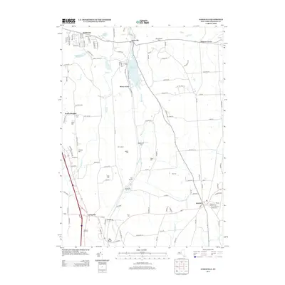
2013 Map of Jamesville
USGS Topo · Published 2013About this map
Butternut Creek carves a central path through this Onondaga County landscape, connecting the Jamesville Reservoir with the rugged elevations of the southern highlands. This modern topographic study reveals a mix of suburban expansion and deep-rooted rural character, anchored by the village of Jamesville and the crossroads at LaFayette. To the east, the historic settlement of Pompey sits atop a ridge, where both the Pompey Hill Protestant Cemetery and Pompey Hill Roman Catholic Cemetery offer valuable insights for genealogists. The rail infrastructure of the NY S & W Railroad follows the valley floor, passing through the narrow passage known as The Tunnel. Numerous smaller family-named landmarks like Mason Hill and Torry Hill persist alongside newer developments like Breezy Acres, illustrating the evolving land use in the hills south of Syracuse.
Find a feature on this map
121 named features on this map. Tap any name to fly to it.
Don’t see what you’re looking for? This feature index may not catch every label — zoom into the map to look around manually.
Map Details
Editions of this 2013 Jamesville Map
This is the sole edition of this map. No revisions or reprints were ever made.
Other maps of this area

1895 · Chittenango
USGS Topo · 1:62,500

1895 · Syracuse
USGS Topo · 1:62,500

1897 · Cazenovia
USGS Topo · 1:62,500

1898 · Syracuse
USGS Topo · 1:62,500

1898 · Chittenango
USGS Topo · 1:62,500

1899 · Cazenovia
USGS Topo · 1:62,500

1900 · Tully
USGS Topo · 1:62,500

1902 · Chittenango
USGS Topo · 1:62,500

1938 · Syracuse East
USGS Topo · 1:24,000

1939 · Syracuse West
USGS Topo · 1:24,000