
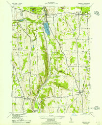
1943 Map of Jamesville
USGS Topo · Published 1943About this map
Jamesville Reservoir and the Delaware Lackawanna and Western railroad corridor anchor this Onondaga County landscape during the early 1940s. The map illustrates a rural society transitioning from historical turnpike travel to modern infrastructure, where the Seneca Turnpike intersects with numerous numbered school districts, such as School No 20 and School No 16. In the northern section, the County Penitentiary stands near Jamesville, while the terrain to the south is defined by steep relief and named features like Arsenal Heights and Miller Hill.
Find a feature on this map
65 named features on this map. Tap any name to fly to it.
Don’t see what you’re looking for? This feature index may not catch every label — zoom into the map to look around manually.
Map Details
Editions of this 1943 Jamesville Map
2 editions found
Other maps of this area

1895 · Chittenango
USGS Topo · 1:62,500

1895 · Syracuse
USGS Topo · 1:62,500

1897 · Cazenovia
USGS Topo · 1:62,500

1898 · Syracuse
USGS Topo · 1:62,500

1898 · Chittenango
USGS Topo · 1:62,500

1899 · Cazenovia
USGS Topo · 1:62,500

1900 · Tully
USGS Topo · 1:62,500

1902 · Chittenango
USGS Topo · 1:62,500

1938 · Syracuse East
USGS Topo · 1:24,000

1939 · Syracuse West
USGS Topo · 1:24,000