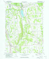
1973 Map of Jamesville
USGS Topo · Published 1977About this map
Jamesville and the surrounding townships of De Witt, LaFayette, and Pompey characterize this central New York landscape during the early 1970s. The area is defined by sharp elevation changes, from the glacial features of Clark Reservation State Park and the deep cut of Smoky Hollow to the high ground of Sentinel Heights and Miller Hill. Local infrastructure is marked by a high concentration of communications technology, including numerous radio towers such as Radio Tower (WSYR) and Radio Tower (WCNY) clustered on the western ridges.
Find a feature on this map
94 named features on this map. Tap any name to fly to it.
Don’t see what you’re looking for? This feature index may not catch every label — zoom into the map to look around manually.
Map Details
Editions of this 1973 Jamesville Map
This is the sole edition of this map. No revisions or reprints were ever made.
Other maps of this area

1895 · Chittenango
USGS Topo · 1:62,500

1895 · Syracuse
USGS Topo · 1:62,500

1897 · Cazenovia
USGS Topo · 1:62,500

1898 · Syracuse
USGS Topo · 1:62,500

1898 · Chittenango
USGS Topo · 1:62,500

1899 · Cazenovia
USGS Topo · 1:62,500

1900 · Tully
USGS Topo · 1:62,500

1902 · Chittenango
USGS Topo · 1:62,500

1938 · Syracuse East
USGS Topo · 1:24,000

1939 · Syracuse West
USGS Topo · 1:24,000