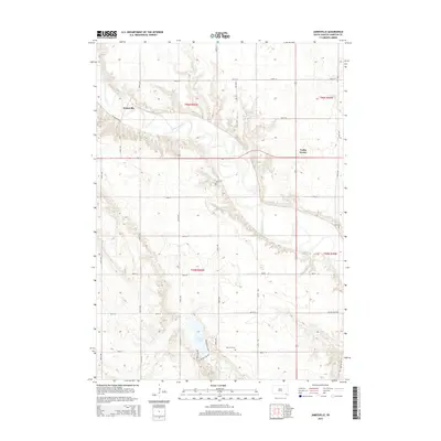
2015 Map of Jamesville
USGS Topo · Published 2015About this map
The James River meanders sharply through the heart of Jamesville Township, defining a landscape dominated by the river's broad floodplains and the high bluffs that hem them in. Near the northern bend sits the small settlement of Jamesville, while to the east, Vedin Corner marks a rural junction along the section lines. This area of Yankton County shows a clear pattern of land use where the upland prairie is gridded for agriculture, contrasted with the winding watercourses of Beaver Cr and Mud Cr that cut through the terrain to join the main river. To the south, Beaver Lake provides a distinct geographic anchor, surrounded by local routes like Beaver Lake Rd and Beaver Beach Rd. For genealogists, the map preserves the locations of Voll Cem and Martinus Cem, which serve as permanent markers of the community's early settlement history.
Find a feature on this map
25 named features on this map. Tap any name to fly to it.
Don’t see what you’re looking for? This feature index may not catch every label — zoom into the map to look around manually.
Map Details
Editions of this 2015 Jamesville Map
This is the sole edition of this map. No revisions or reprints were ever made.
Other maps of this area

1898 · Olivet
USGS Topo · 1:125,000

1898 · Parker
USGS Topo · 1:125,000

1955 · Sioux City
USGS Topo · 1:250,000

1955 · Sioux Falls
USGS Topo · 1:250,000

1957 · Mayfield
USGS Topo · 1:24,000

1957 · Midway
USGS Topo · 1:24,000

1957 · Mission Hill
USGS Topo · 1:24,000

1957 · Menno
USGS Topo · 1:24,000

1957 · Jamesville
USGS Topo · 1:24,000

1958 · Sioux City
USGS Topo · 1:250,000
Featured Places
- Jamesville, SD
- Walshtown Township, SD
- Mayfield Township, SD
- Central Township, SD
- Jamesville Township, SD