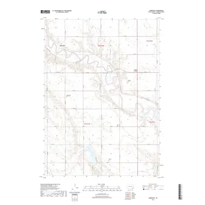
2017 Map of Jamesville
USGS Topo · Published 2017About this map
The James River meanders sharply across this Yankton County landscape, defining the character of the river valley as it passes through Jamesville and past the junction at Vedin Corner. This modern topographical survey illustrates a mature agricultural grid where section lines are maintained as gravel and paved routes, such as 297th St and 438th Ave. The distribution of burial grounds across the township, including the Braunsreuther Family Cem and the Pleasant Hill Cem, provides significant geographic anchors for genealogists studying the area's rural heritage.
Find a feature on this map
36 named features on this map. Tap any name to fly to it.
Don’t see what you’re looking for? This feature index may not catch every label — zoom into the map to look around manually.
Map Details
Editions of this 2017 Jamesville Map
This is the sole edition of this map. No revisions or reprints were ever made.
Other maps of this area

1898 · Olivet
USGS Topo · 1:125,000

1898 · Parker
USGS Topo · 1:125,000

1955 · Sioux City
USGS Topo · 1:250,000

1955 · Sioux Falls
USGS Topo · 1:250,000

1957 · Mayfield
USGS Topo · 1:24,000

1957 · Midway
USGS Topo · 1:24,000

1957 · Mission Hill
USGS Topo · 1:24,000

1957 · Menno
USGS Topo · 1:24,000

1957 · Jamesville
USGS Topo · 1:24,000

1958 · Sioux City
USGS Topo · 1:250,000
Featured Places
- Jamesville, SD
- Walshtown Township, SD
- Mayfield Township, SD
- Central Township, SD
- Jamesville Township, SD