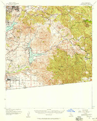
1955 Map of Jamul
USGS Topo · Published 1958About this map
Savage Dam and the Lower Otay Reservoir anchor the southern landscape of this mid-1950s survey of the San Diego backcountry. The region's transition from agricultural ranching to strategic military and suburban growth is evident in the presence of the Brown Field Naval Auxiliary Air Station near the international border, contrasted with long-standing ranching operations like the Otay Ranch, Kuebler Ranch, and Monte Vista Ranch. The topography is dominated by the San Ysidro Mountains and San Miguel Mts, where the rugged terrain is carved by Dulzura Creek and Steele Canyon. Small communities and landmarks such as Jamul, Dulzura, and the Indian Church illustrate the localized settlement patterns before the extensive modern expansion of the San Diego metro area. The map also delineates the Otay (Dominguez) Grant Boundary and Otay (Estudillo) Grant Boundary, preserving the historical land grant divisions of the Spanish and Mexican eras.
Find a feature on this map
75 named features on this map. Tap any name to fly to it.
Don’t see what you’re looking for? This feature index may not catch every label — zoom into the map to look around manually.
Map Details
Editions of this 1955 Jamul Map
3 editions found
Other maps of this area

1893 · El Cajon
USGS Topo · 1:62,500

1901 · Elcajon
USGS Topo · 1:62,500

1903 · Cuyamaca
USGS Topo · 1:125,000

1903 · La Jolla
USGS Topo · 1:62,500

1903 · Elcajon
USGS Topo · 1:62,500

1904 · San Diego
USGS Topo · 1:62,500

1904 · Southern California Sheet No. 2
USGS Topo · 1:250,000

1930 · La Jolla
USGS Topo · 1:62,500

1930 · San Diego
USGS Topo · 1:62,500

1939 · El Cajon
USGS Topo · 1:62,500