2021 Map of Jane
USGS Topo · Published 2021About this map
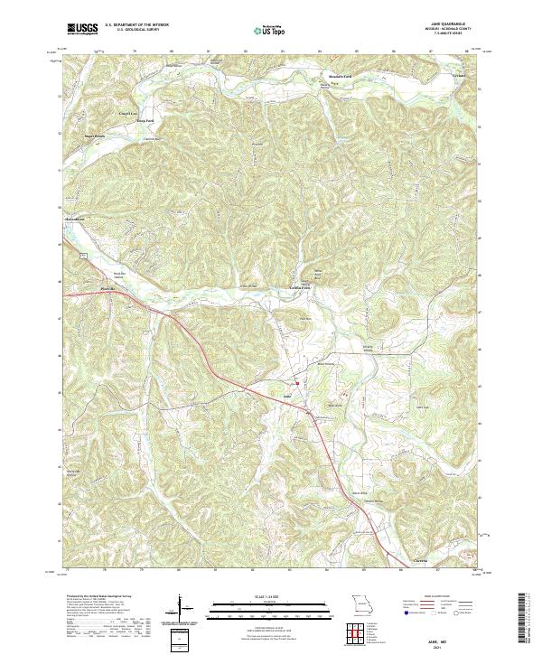
Jane serves as a central hub in this corner of McDonald County, where the Ozark landscape is defined by the winding paths of Big Sugar Creek and Little Sugar Creek. The topography is marked by numerous named hollows and bluffs, suggesting a terrain of steep ridges and narrow valleys that have historically dictated the placement of settlements and roads. Key water crossings like Meadors Ford, Griffin Ford, and Deep Ford indicate traditional transit points along the creeks, while localized clusters like Sugar Beach and Crag O Lea point to the area's development as a destination for outdoor recreation. High points such as Polk Mtn and Bobs Knob overlook a network of county roads and state highways that connect rural homesteads and larger communities like Pineville and Cyclone.
Find a feature on this map
102 named features on this map. Tap any name to fly to it.
Don’t see what you’re looking for? This feature index may not catch every label — zoom into the map to look around manually.
Map Details
Editions of this 2021 Jane Map
This is the sole edition of this map. No revisions or reprints were ever made.