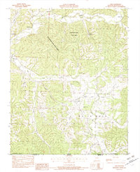
1982 Map of Jane
USGS Topo · Published 1982About this map
Jane sits near the southern edge of McDonald County, Missouri, at a time when the rural landscape was defined by the winding paths of Big Sugar Creek and Little Sugar Creek. The 1982 topography reveals a region of sharp ridges and deep hollows, including Wolf Pen Hollow and Miser Hollow. To the north, the Huckleberry Ridge State Forest covers a significant portion of the highland, while small communities and vacation spots like Sugar Beach and Crag O Lea dot the creek banks.
Find a feature on this map
40 named features on this map. Tap any name to fly to it.
Don’t see what you’re looking for? This feature index may not catch every label — zoom into the map to look around manually.
Map Details
Editions of this 1982 Jane Map
This is the sole edition of this map. No revisions or reprints were ever made.
Other maps of this area

1899 · Fayetteville
USGS Topo · 1:125,000

1901 · Fayetteville
USGS Topo · 1:125,000

1904 · Fayetteville
USGS Topo · 1:125,000

1940 · Noel
USGS Topo · 1:62,500

1941 · Rocky Comfort
USGS Topo · 1:62,500

1943 · Noel
USGS Topo · 1:62,500

1943 · Rocky Comfort
USGS Topo · 1:62,500

1954 · Tulsa
USGS Topo · 1:250,000

1958 · Tulsa
USGS Topo · 1:250,000

1963 · Tulsa
USGS Topo · 1:250,000