1962 Map of Janesville
USGS Topo · Published 1964About this map
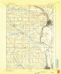
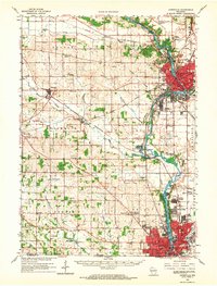
Janesville and Beloit anchor this mid-century survey of the Rock River valley, appearing as significant industrial and residential centers during a period of steady post-war expansion. The Rock River serves as the central geographic spine, flanked by the residential developments of Garden Village and Holiday Hills. The landscape reveals a complex network of transportation, where the Chicago and North Western and Chicago Milwaukee St Paul and Pacific railroads intersect with burgeoning aviation at the Rock County Airport.
Find a feature on this map
103 named features on this map. Tap any name to fly to it.
Don’t see what you’re looking for? This feature index may not catch every label — zoom into the map to look around manually.
Map Details
Editions of this 1962 Janesville Map
This is the sole edition of this map. No revisions or reprints were ever made.
Historical Maps of Janesville Through Time
3 maps found