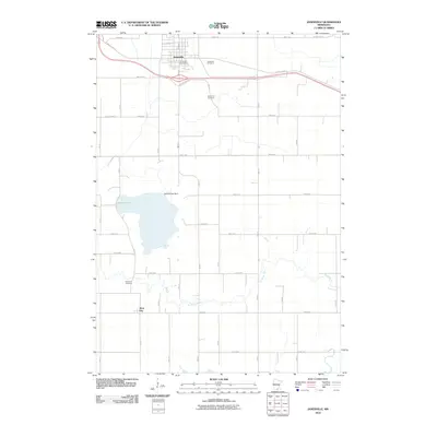
2010 Map of Janesville
USGS Topo · Published 2010About this map
Janesville anchors the northern portion of this map, appearing as a developed hub with its own Janesville Post Office and a grid of streets including N Main St and S Main St. The landscape south of town transitions into a rural agricultural pattern defined by the meandering Le Sueur River and the significant basin of Buffalo Lake. This water body is managed by the Buffalo Lake Dam, highlighting the managed nature of the local hydrography at the start of the 21st century.
Find a feature on this map
38 named features on this map. Tap any name to fly to it.
Don’t see what you’re looking for? This feature index may not catch every label — zoom into the map to look around manually.
Map Details
Editions of this 2010 Janesville Map
This is the sole edition of this map. No revisions or reprints were ever made.
Other maps of this area

1950 · Mankato East
USGS Topo · 1:62,500

1951 · Mankato East
USGS Topo · 1:62,500

1953 · Saint Paul
USGS Topo · 1:250,000

1954 · Mason City
USGS Topo · 1:250,000

1957 · Mason City
USGS Topo · 1:250,000

1958 · Mason City
USGS Topo · 1:250,000

1959 · Saint Paul
USGS Topo · 1:250,000

1966 · Waseca
USGS Topo · 1:24,000

1966 · Janesville
USGS Topo · 1:24,000

1966 · Waterville
USGS Topo · 1:24,000