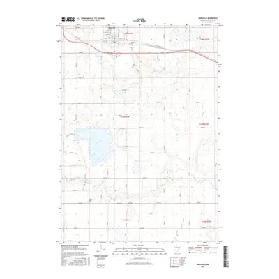
2016 Map of Janesville
USGS Topo · Published 2016About this map
Janesville anchors the northern portion of this Waseca County landscape, situated along the corridor of Old US Hwy 14 and W Front St. This 2016 survey captures a region defined by its transition between agricultural plots and the intricate wetlands surrounding Buffalo Lake and Helena Lake. To the south, the settlement of Alma City sits near the meandering path of the Le Sueur River, which cuts through the southern townships of T107N R24W and T106N R24W.
Find a feature on this map
39 named features on this map. Tap any name to fly to it.
Don’t see what you’re looking for? This feature index may not catch every label — zoom into the map to look around manually.
Map Details
Editions of this 2016 Janesville Map
This is the sole edition of this map. No revisions or reprints were ever made.
Other maps of this area

1950 · Mankato East
USGS Topo · 1:62,500

1951 · Mankato East
USGS Topo · 1:62,500

1953 · Saint Paul
USGS Topo · 1:250,000

1954 · Mason City
USGS Topo · 1:250,000

1957 · Mason City
USGS Topo · 1:250,000

1958 · Mason City
USGS Topo · 1:250,000

1959 · Saint Paul
USGS Topo · 1:250,000

1966 · Waseca
USGS Topo · 1:24,000

1966 · Janesville
USGS Topo · 1:24,000

1966 · Waterville
USGS Topo · 1:24,000