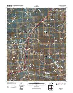
2011 Map of Jarratt
USGS Topo · Published 2011About this map
Jarratt serves as the primary hub of this Southside Virginia landscape, situated where the interstate corridor intersects local routes near the Jarratt Post Office. The area is defined by an extensive network of waterways and wetlands, including the Nottoway River and Chetocric Swamp to the west, and Poplar Swamp to the east. These hydrologic features historically supported local industry, evidenced by Harrells Mill and the associated Harrells Mill Pond and Harrells Dam. Local family and community history is anchored by several burial grounds, such as High Hills Cemetery and Hassidiah Cemetery near the town center, and Jerusalem Cemetery further east. Small settlements like Owens, Henry, and Mason are scattered along the periphery, connected by rural corridors such as Kientz Rd and Grizzard Rd, reflecting the region's enduring agricultural and timber-land character.
Find a feature on this map
60 named features on this map. Tap any name to fly to it.
Don’t see what you’re looking for? This feature index may not catch every label — zoom into the map to look around manually.
Map Details
Editions of this 2011 Jarratt Map
This is the sole edition of this map. No revisions or reprints were ever made.
Other maps of this area

1919 · Jarratt
USGS Topo · 1:62,500

1919 · Mc Kenney
USGS Topo · 1:48,000

1919 · Emporia
USGS Topo · 1:62,500

1919 · Arringdale
USGS Topo · 1:48,000

1920 · Arringdale
USGS Topo · 1:62,500

1921 · Mc Kenney
USGS Topo · 1:62,500

1942 · Arringdale
USGS Topo · 1:62,500

1942 · Emporia
USGS Topo · 1:62,500

1943 · Mc Kenney
USGS Topo · 1:62,500

1951 · Jarratt
USGS Topo · 1:62,500