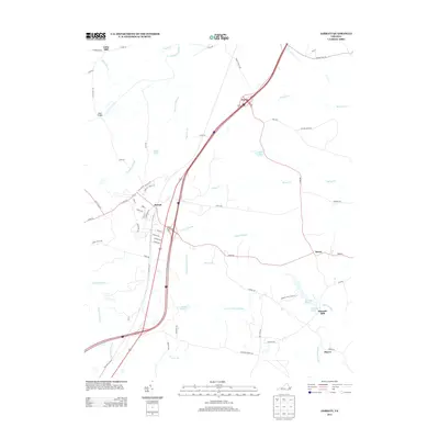
2013 Map of Jarratt
USGS Topo · Published 2013About this map
The town of Jarratt serves as the central hub of this Southside Virginia landscape, situated where local roads and modern thoroughfares intersect. The terrain is defined by a dense network of hydrologic features, including the Nottoway River and vast wetland systems such as Chetocric Swamp, Otterdam Swamp, and Poplar Swamp. These watercourses historically shaped the settlement patterns of the region, leading to the establishment of small communities and crossroads like Henry, Owens, and Little Mill. The presence of Harrells Mill and Harrells Pond suggests a legacy of local industry reliant on these water resources. Away from the town center, the map reveals a pattern of dispersed homesteads and named ponds like Bailys Pond and Creath Pond, reflecting a rural economy deeply integrated with the wooded lowlands and creek drainages that dominate the Sussex and Greensville County borderlands.
Find a feature on this map
77 named features on this map. Tap any name to fly to it.
Don’t see what you’re looking for? This feature index may not catch every label — zoom into the map to look around manually.
Map Details
Editions of this 2013 Jarratt Map
This is the sole edition of this map. No revisions or reprints were ever made.
Other maps of this area

1919 · Jarratt
USGS Topo · 1:62,500

1919 · Mc Kenney
USGS Topo · 1:48,000

1919 · Emporia
USGS Topo · 1:62,500

1919 · Arringdale
USGS Topo · 1:48,000

1920 · Arringdale
USGS Topo · 1:62,500

1921 · Mc Kenney
USGS Topo · 1:62,500

1942 · Arringdale
USGS Topo · 1:62,500

1942 · Emporia
USGS Topo · 1:62,500

1943 · Mc Kenney
USGS Topo · 1:62,500

1951 · Jarratt
USGS Topo · 1:62,500