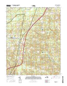
2016 Map of Jarratt
USGS Topo · Published 2016About this map
The Nottoway River serves as the natural boundary between Sussex and Greensville counties, anchoring a landscape defined by extensive wetlands and swamp drainage systems. Near the town of Jarratt, the terrain is heavily marked by these hydrologic features, including Harris Swamp, Chetoteric Swamp, and Flat Swamp. This 2016 survey illustrates the persistent rural character of the region, where family legacies are preserved in sites such as the Grigg Family Cem and the Jerusalem Cem. Local industry and navigation are hinted at by place names like Harrells Mill and Little Mill, alongside scattered settlements like Owens and Henry. The presence of several distinct burial grounds, including High Hills Cem and Hassidiah Cem, provides valuable points of reference for genealogical research in this part of southern Virginia.
Find a feature on this map
69 named features on this map. Tap any name to fly to it.
Don’t see what you’re looking for? This feature index may not catch every label — zoom into the map to look around manually.
Map Details
Editions of this 2016 Jarratt Map
This is the sole edition of this map. No revisions or reprints were ever made.
Other maps of this area

1919 · Jarratt
USGS Topo · 1:62,500

1919 · Mc Kenney
USGS Topo · 1:48,000

1919 · Emporia
USGS Topo · 1:62,500

1919 · Arringdale
USGS Topo · 1:48,000

1920 · Arringdale
USGS Topo · 1:62,500

1921 · Mc Kenney
USGS Topo · 1:62,500

1942 · Arringdale
USGS Topo · 1:62,500

1942 · Emporia
USGS Topo · 1:62,500

1943 · Mc Kenney
USGS Topo · 1:62,500

1951 · Jarratt
USGS Topo · 1:62,500