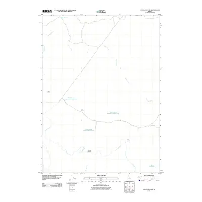
2010 Map of Jarvis Pasture
USGS Topo · Published 2010About this map
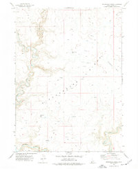
Jarvis Pasture serves as the focal point for this high-desert rangeland survey, where life and activity revolve around the management of water in a semi-arid landscape. The Owyhee River carves through the southwestern corner of the quadrangle, joined by the seasonal flows of Juniper Creek and the meandering path of Yatahoney Creek. This map reveals a sophisticated network of ranching infrastructure, specifically the numbering of several collection points such as Jarvis Pasture Reservoir Number One, Jarvis Pasture Reservoir Number Two, and Jarvis Pasture Reservoir Number Three. These named catchments, along with Wiley Reservoir and Beck Reservoir, highlight the critical importance of water rights and livestock management in this corner of Owyhee County. The terrain is marked by distinctive geological features like Windy Point and the evocative naming of Hole Up Canyon and Holdup Canyon, while the Garaf Trl provides a primary route through the open country.
Find a feature on this map
13 named features on this map. Tap any name to fly to it.
Don’t see what you’re looking for? This feature index may not catch every label — zoom into the map to look around manually.
Map Details
Editions of this 2010 Jarvis Pasture Map
This is the sole edition of this map. No revisions or reprints were ever made.
Other maps of this area

1955 · Jordan Valley
USGS Topo · 1:250,000

1957 · Jordan Valley
USGS Topo · 1:250,000

1958 · Jordan Valley
USGS Topo · 1:250,000

1971 · Juniper Basin SE
USGS Topo · 1:24,000

1971 · Juniper Basin
USGS Topo · 1:24,000
1971 · Jarvis Pasture
USGS Topo · 1:24,000

1971 · Ross Lake
USGS Topo · 1:24,000
1972 · Shoofly Springs
USGS Topo · 1:24,000
1972 · Battle Creek Lakes
USGS Topo · 1:24,000
1973 · Dickshooter Ridge
USGS Topo · 1:24,000