
1971 Map of Juniper Basin
USGS Topo · Published 1974About this map
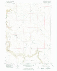
The Juniper Basin landscape in the early 1970s is defined by a high-desert drainage system flowing toward the Owyhee River. This Idaho-Nevada borderland features a sprawling water management network essential for ranching, centered on the Juniper Basin Reservoir and the Juniper Basin Ranch. The rugged topography is etched by Juniper Creek and Hole Up Creek, illustrating how seasonal water sources were captured in various basins like Y P Reservoir No 1 and Y P Reservoir No 33 for livestock and irrigation.
Find a feature on this map
18 named features on this map. Tap any name to fly to it.
Don’t see what you’re looking for? This feature index may not catch every label — zoom into the map to look around manually.
Map Details
Editions of this 1971 Juniper Basin Map
This is the sole edition of this map. No revisions or reprints were ever made.
Other maps of this area

1955 · McDermitt
USGS Topo · 1:250,000

1955 · Jordan Valley
USGS Topo · 1:250,000

1957 · Jordan Valley
USGS Topo · 1:250,000

1958 · Jordan Valley
USGS Topo · 1:250,000

1959 · McDermitt
USGS Topo · 1:250,000

1964 · Hat Peak
USGS Topo · 1:62,500

1971 · Juniper Basin SE
USGS Topo · 1:24,000
1971 · Jarvis Pasture
USGS Topo · 1:24,000

1971 · Ross Lake
USGS Topo · 1:24,000
1973 · Four Corners
USGS Topo · 1:24,000