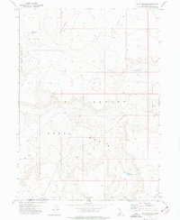
1973 Map of Four Corners
USGS Topo · Published 1977About this map
Whitehorse Butte overlooks a high desert landscape where the borders of Idaho and Nevada meet in the 1970s. This arid terrain is defined by its catchment systems, which were essential for managing livestock in the vast Horse Basin and Juniper Basin. Isolated settlements and temporary outposts such as Four Corners and State Line Camp anchor a network of unimproved roads and fence lines that crisscross the Y P Desert. The reliance on surface water is evident in the strategic placement of the Four Corners Reservoir, Little Juniper Basin Res, and East Horse Basin Reservoir. A prominent pipeline and various benchmarks like BM 5215 trace the efforts of surveyors and engineers to navigate and utilize this remote high-plateau environment during the early 1970s.
Find a feature on this map
21 named features on this map. Tap any name to fly to it.
Don’t see what you’re looking for? This feature index may not catch every label — zoom into the map to look around manually.
Map Details
Editions of this 1973 Four Corners Map
This is the sole edition of this map. No revisions or reprints were ever made.
Other maps of this area

1955 · McDermitt
USGS Topo · 1:250,000

1955 · Jordan Valley
USGS Topo · 1:250,000

1957 · Jordan Valley
USGS Topo · 1:250,000

1958 · Jordan Valley
USGS Topo · 1:250,000

1959 · McDermitt
USGS Topo · 1:250,000

1964 · Hat Peak
USGS Topo · 1:62,500

1971 · Juniper Basin
USGS Topo · 1:24,000
1971 · Jarvis Pasture
USGS Topo · 1:24,000
1973 · Piute Basin West
USGS Topo · 1:24,000

1973 · Bull Camp Butte
USGS Topo · 1:24,000