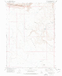
1973 Map of Piute Basin West
USGS Topo · Published 1976About this map
The Owyhee River carves across the northern edge of this high-desert landscape in Owyhee County, defining a region where water management is central to the land's utility. During the early 1970s, this area of the Piute Desert and Piute Basin was characterized by a network of catchments and reservoirs, including Burts Res, Clay Bottom Res, and North Lookout Res. These features, along with the noted Corrals and Piute Basin Camp, suggest a landscape primarily utilized for seasonal livestock grazing rather than permanent township settlement. The terrain rises toward the south at Lookout Butte, while the drainage of Piute Creek and its associated Piute Creek Res provide critical landmarks in an otherwise sparse and open territory. This survey captures the essential infrastructure of the Idaho rangelands before modern shifts in land use or environmental management.
Find a feature on this map
13 named features on this map. Tap any name to fly to it.
Don’t see what you’re looking for? This feature index may not catch every label — zoom into the map to look around manually.
Map Details
Editions of this 1973 Piute Basin West Map
This is the sole edition of this map. No revisions or reprints were ever made.
Other maps of this area

1955 · Jordan Valley
USGS Topo · 1:250,000

1957 · Jordan Valley
USGS Topo · 1:250,000

1958 · Jordan Valley
USGS Topo · 1:250,000

1973 · Coyote Hole
USGS Topo · 1:24,000

1973 · Red Basin
USGS Topo · 1:24,000

1973 · Grassy Ridge
USGS Topo · 1:24,000

1973 · Bull Camp Butte
USGS Topo · 1:24,000

1973 · Brace Flat
USGS Topo · 1:24,000
1973 · Dickshooter Ridge
USGS Topo · 1:24,000
1973 · Four Corners
USGS Topo · 1:24,000