
1973 Map of Grassy Ridge
USGS Topo · Published 1976About this map
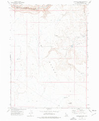
South Fork Owyhee River carves a deep, winding path through the southwest corner of this landscape, marking a sharp transition from the elevated Grassy Ridge and the arid expanse of the Owyhee Desert. The map documents a sparsely populated ranching environment where life and movement are tied to isolated water sources like Shea Res, Coyote Flat Res, and Coyote Hole Res. Near a sharp bend in the river, the 45 Ranch stands as a primary hub of activity, supported by a nearby Corral and the 45 Landing Strip. High-clearance Jeep Trail networks provide the only access across Coyote Flat, illustrating the remote nature of this high-plateau region during the early 1970s.
Find a feature on this map
17 named features on this map. Tap any name to fly to it.
Don’t see what you’re looking for? This feature index may not catch every label — zoom into the map to look around manually.
Map Details
Editions of this 1973 Grassy Ridge Map
This is the sole edition of this map. No revisions or reprints were ever made.
Other maps of this area

1955 · Jordan Valley
USGS Topo · 1:250,000

1957 · Jordan Valley
USGS Topo · 1:250,000

1958 · Jordan Valley
USGS Topo · 1:250,000

1973 · Coyote Hole
USGS Topo · 1:24,000

1973 · Red Basin
USGS Topo · 1:24,000
1973 · Piute Basin West
USGS Topo · 1:24,000

1973 · Spring Creek Basin
USGS Topo · 1:24,000

1973 · Bull Camp Butte
USGS Topo · 1:24,000
1973 · Star Valley
USGS Topo · 1:24,000

1973 · Brace Flat
USGS Topo · 1:24,000