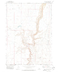
1973 Map of Star Valley
USGS Topo · Published 1977About this map
The Little Owyhee River carves a deep path through the high plateau country of the Idaho-Nevada border in this early 1970s survey. The landscape is defined by its water management and grazing infrastructure, featuring a network of livestock reservoirs such as Sorrel Res, Tent Creek Res, and Sundown Res. The Star Valley Ranch and a nearby Well serve as focal points for human activity in this arid environment. The map details the transition from the broad expanse of Halogeton Flat to the dramatic topography of the Star Valley and the Walcot Basin. A primitive network of Jeep Trails provides the primary means of traversal, connecting remote landmarks like the Walcot Basin Reservoir across the state line between Owyhee County and Elko County.
Find a feature on this map
27 named features on this map. Tap any name to fly to it.
Don’t see what you’re looking for? This feature index may not catch every label — zoom into the map to look around manually.
Map Details
Editions of this 1973 Star Valley Map
This is the sole edition of this map. No revisions or reprints were ever made.
Other maps of this area

1882 · Paradise
USGS Topo · 1:250,000

1893 · Paradise
USGS Topo · 1:250,000

1955 · McDermitt
USGS Topo · 1:250,000

1955 · Jordan Valley
USGS Topo · 1:250,000

1957 · Jordan Valley
USGS Topo · 1:250,000

1958 · Jordan Valley
USGS Topo · 1:250,000

1959 · McDermitt
USGS Topo · 1:250,000

1973 · Coyote Hole
USGS Topo · 1:24,000

1973 · Grassy Ridge
USGS Topo · 1:24,000

1973 · Spring Creek Basin
USGS Topo · 1:24,000