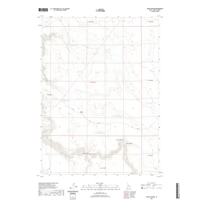
2020 Map of Jarvis Pasture
USGS Topo · Published 2020About this map
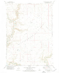
Jarvis Pasture and the surrounding high desert of Owyhee County are defined by a complex network of water management and deep canyon topography. The Owyhee River carves through the southern portion of the map, creating dramatic features like Owyhee Canyon and Hole Up Canyon. This 2020 record illustrates the vital role of artificial water sources in this arid landscape, featuring the Wiley Reservoir in the north and a series of sequential catchments including Jarvis Pasture Reservoir Number One, Jarvis Pasture Reservoir Number Two, and Jarvis Pasture Reservoir Number Three. Access across this remote terrain is primarily facilitated by the Garaf Trl, which winds through the central pasture toward Windy Point. The map also captures several smaller drainages like Yatahoney Cr and Juniper Cr, which feed into the larger river system or seasonal basins like Juniper Basin.
Find a feature on this map
21 named features on this map. Tap any name to fly to it.
Don’t see what you’re looking for? This feature index may not catch every label — zoom into the map to look around manually.
Map Details
Editions of this 2020 Jarvis Pasture Map
This is the sole edition of this map. No revisions or reprints were ever made.
Other maps of this area

1955 · Jordan Valley
USGS Topo · 1:250,000

1957 · Jordan Valley
USGS Topo · 1:250,000

1958 · Jordan Valley
USGS Topo · 1:250,000

1971 · Juniper Basin SE
USGS Topo · 1:24,000

1971 · Juniper Basin
USGS Topo · 1:24,000
1971 · Jarvis Pasture
USGS Topo · 1:24,000

1971 · Ross Lake
USGS Topo · 1:24,000
1972 · Shoofly Springs
USGS Topo · 1:24,000
1972 · Battle Creek Lakes
USGS Topo · 1:24,000
1973 · Dickshooter Ridge
USGS Topo · 1:24,000