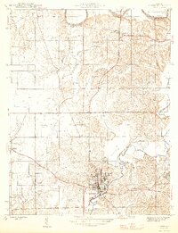
1946 Map of Jasper
USGS Topo · Published 1946About this map
Jasper serves as the primary hub of this Dubois County landscape, situated where the Southern railroad meets the winding course of the Patoka River. The 1940s terrain is marked by a network of rural schoolhouses and family-named cemeteries that speak to the established agricultural communities of the era. To the west, the settlement of Ireland is surrounded by landmarks like Shiloh Ch and the Alexander Cem, while the northern reaches show the East Fork White River bordering the townships near Portersville and Haysville. This survey documents a critical period of local infrastructure, capturing the many small schools like Ackerman Sch and Dick Sch before mid-century consolidations changed the rural educational footprint. The landscape varies from the distinctive Flat near the Buffalo River to the small-scale extraction indicated by the Cooper Gem mine.
Find a feature on this map
30 named features on this map. Tap any name to fly to it.
Don’t see what you’re looking for? This feature index may not catch every label — zoom into the map to look around manually.
Map Details
Editions of this 1946 Jasper Map
2 editions found
Other maps of this area

1902 · Ditney
USGS Topo · 1:125,000

1903 · Velpen
USGS Topo · 1:62,500

1944 · Glendale
USGS Topo · 1:24,000

1946 · Jasper
USGS Topo · 1:24,000

1954 · Dubois
USGS Topo · 1:24,000

1954 · Huntingburg
USGS Topo · 1:24,000

1955 · Saint Anthony
USGS Topo · 1:24,000

1956 · Alfordsville
USGS Topo · 1:24,000

1956 · Rusk
USGS Topo · 1:24,000

1956 · Vincennes
USGS Topo · 1:250,000