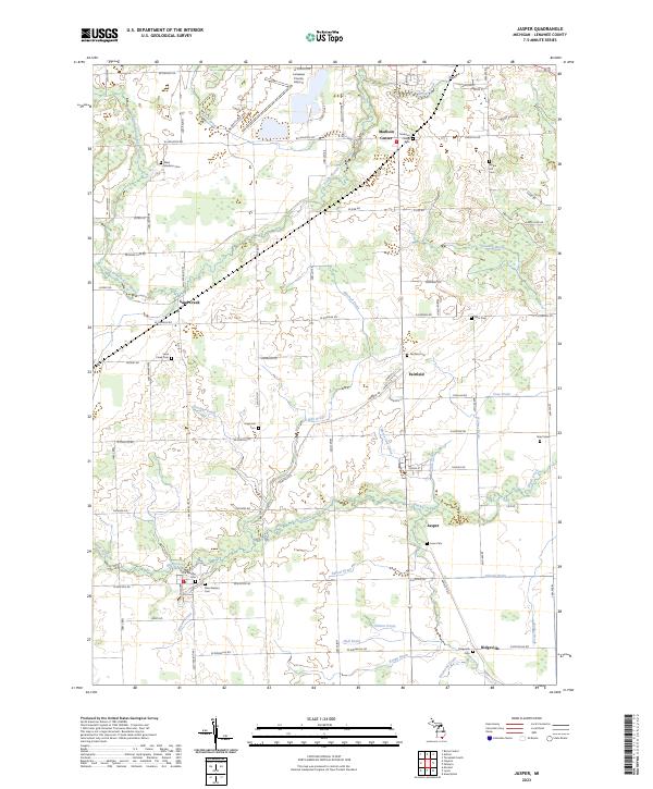
2023 Map of Jasper
USGS Topo · Published 2023About this map
Madison Center and Fairfield anchor a landscape defined by an intricate network of agricultural drainage systems and small rural settlements in Lenawee County. The terrain is marked by a complex web of waterways, including South Branch River Raisin, Black Creek, and numerous man-made channels like Mitchell Drain and Hoadley Drain, reflecting generations of landscape engineering to support local farming. Genealogists will find a wealth of burial sites scattered throughout the township, ranging from the Old Weston Cem and New Weston Cem near the southern boundary to the Apple Hill Cem and Hagaman Cem further north.
Find a feature on this map
93 named features on this map. Tap any name to fly to it.
Don’t see what you’re looking for? This feature index may not catch every label — zoom into the map to look around manually.
Map Details
Editions of this 2023 Jasper Map
This is the sole edition of this map. No revisions or reprints were ever made.
Other maps of this area

1911 · Wauseon
USGS Topo · 1:62,500

1911 · Swanton
USGS Topo · 1:62,500

1913 · Wauseon
USGS Topo · 1:62,500

1914 · Swanton
USGS Topo · 1:62,500

1939 · Blissfield
USGS Topo · 1:62,500

1941 · Blissfield
USGS Topo · 1:62,500

1943 · Wauseon
USGS Topo · 1:62,500

1953 · Fort Wayne
USGS Topo · 1:250,000

1956 · Fort Wayne
USGS Topo · 1:250,000

1956 · Toledo
USGS Topo · 1:250,000