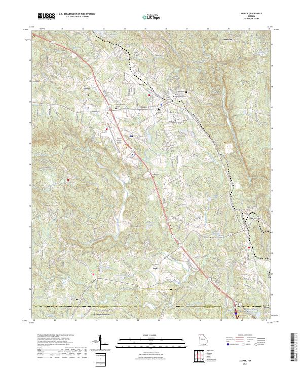
2024 Map of Jasper
USGS Topo · Published 2024About this map
Jasper serves as the focal point of this North Georgia survey, centered on the Pickens County Courthouse and the surrounding street grid including N Main St and W Church St. The landscape is a complex network of ridges like Sharp Mountain and Oak Morris Ridge, drained by numerous waterways including Pettit Creek and Long Swamp Creek. The mapping reveals a transition from the urban center of Jasper to smaller surrounding communities such as Tate, Nelson, and Ruden.
Find a feature on this map
59 named features on this map. Tap any name to fly to it.
Don’t see what you’re looking for? This feature index may not catch every label — zoom into the map to look around manually.
Map Details
Editions of this 2024 Jasper Map
This is the sole edition of this map. No revisions or reprints were ever made.
Other maps of this area

1886 · Dalton
USGS Topo · 1:125,000

1888 · Ellijay
USGS Topo · 1:125,000

1890 · Suwanee
USGS Topo · 1:125,000

1890 · Cartersville
USGS Topo · 1:125,000

1891 · Cartersville
USGS Topo · 1:125,000

1892 · Ellijay
USGS Topo · 1:125,000

1892 · Dalton
USGS Topo · 1:125,000

1894 · Suwanee
USGS Topo · 1:125,000

1896 · Cartersville
USGS Topo · 1:125,000

1897 · Dalton
USGS Topo · 1:125,000