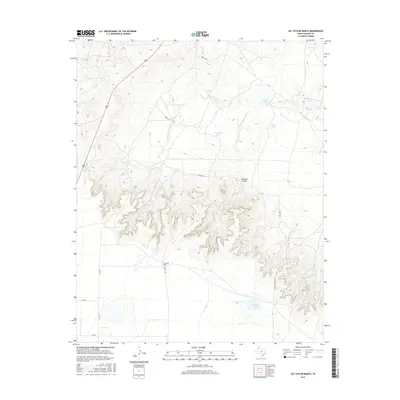
2016 Map of Jay Taylor Ranch
USGS Topo · Published 2016About this map
Jay Taylor Ranch serves as a focal point in this portion of Oldham County, where the High Plains terrain is deeply incised by the drainage systems of Sierrita de la Cruz Cr and Mitchell Canyon Cr. The landscape is defined by the complex topography of Mitchell Canyon, which cuts through the center of the sheet, revealing the underlying geology of the Canadian River break country. Water management is central to the land use here, as evidenced by a network of named water sources including Red Lake, Taylor Lake, and Division Lake, alongside numerous stock ponds like Horseshoe Tank and Eagle Tank. These features, connected by a simple grid of rural routes such as Everett Rd and Binford Rd, reflect the enduring ranching economy of the Texas Panhandle during the early 21st century.
Find a feature on this map
21 named features on this map. Tap any name to fly to it.
Don’t see what you’re looking for? This feature index may not catch every label — zoom into the map to look around manually.
Map Details
Editions of this 2016 Jay Taylor Ranch Map
This is the sole edition of this map. No revisions or reprints were ever made.
Other maps of this area

1934 · Ady
USGS Topo · 1:62,500

1936 · Ady
USGS Topo · 1:62,500

1954 · Tucumcari
USGS Topo · 1:250,000

1958 · Tucumcari
USGS Topo · 1:250,000

1962 · Wildorado
USGS Topo · 1:62,500

1965 · Everett
USGS Topo · 1:24,000

1966 · Jay Taylor Ranch
USGS Topo · 1:24,000

1966 · Halfway Creek
USGS Topo · 1:24,000

1966 · Ady
USGS Topo · 1:24,000

1966 · Rotten Hill
USGS Topo · 1:24,000