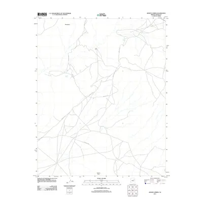
2011 Map of Jeddito Spring
USGS Topo · Published 2011About this map
Jeddito Spring serves as a vital water source in this high desert landscape within the Navajo Nation. The terrain is marked by significant landmarks such as Stephen Butte and the cultural site at Kawaika-A, illustrating the deep connection between geography and indigenous settlement history. A network of routes, including Indian Rte-9759 and Indian Rte-9102, crisscrosses the arid plains, connecting isolated water points like Indian Spring and Sand Spring. These features suggest a landscape where transportation and survival have long been dictated by the location of reliable springs. This 2011 survey by the U.S. Geological Survey documents the region's sparse infrastructure, dominated by secondary roads like Skunk Springs Rd and Indian Rte-9067.
Find a feature on this map
10 named features on this map. Tap any name to fly to it.
Don’t see what you’re looking for? This feature index may not catch every label — zoom into the map to look around manually.
Map Details
Editions of this 2011 Jeddito Spring Map
This is the sole edition of this map. No revisions or reprints were ever made.
Other maps of this area

1883 · Tusayan
USGS Topo · 1:250,000

1886 · Tusayan
USGS Topo · 1:250,000

1947 · Flagstaff
USGS Topo · 1:250,000

1954 · Flagstaff
USGS Topo · 1:250,000

1958 · Flagstaff
USGS Topo · 1:250,000

1960 · Flagstaff
USGS Topo · 1:250,000

1962 · Flagstaff
USGS Topo · 1:250,000

1966 · White Cone
USGS Topo · 1:62,500

1966 · Egloffstein Butte
USGS Topo · 1:62,500
1966 · Keams Canyon
USGS Topo · 1:62,500