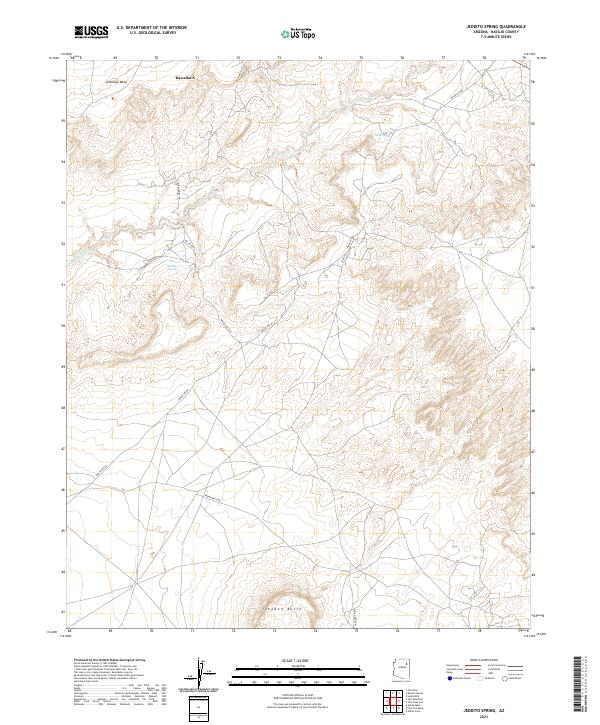
2021 Map of Jeddito Spring
USGS Topo · Published 2021About this map
Antelope Mesa and the prominent rising form of Stephen Butte anchor this high-desert landscape in northeastern Arizona. The map details a complex network of traditional routes and modern access ways, including Indian Rte 60 and Skunk Spring Rd, which traverse the arid terrain. Water sources, vital for life in this region, are clearly marked, featuring both Jeddito Spring and Sand Spring. These landmarks, along with the drainage of Jeddito Wash, define the movement and settlement patterns across the Navajo County landscape. The inclusion of Kawaika-A reflects the deep cultural and archaeological significance of this area, where landforms are intertwined with historical human presence.
Find a feature on this map
17 named features on this map. Tap any name to fly to it.
Don’t see what you’re looking for? This feature index may not catch every label — zoom into the map to look around manually.
Map Details
Editions of this 2021 Jeddito Spring Map
This is the sole edition of this map. No revisions or reprints were ever made.
Other maps of this area

1883 · Tusayan
USGS Topo · 1:250,000

1886 · Tusayan
USGS Topo · 1:250,000

1947 · Flagstaff
USGS Topo · 1:250,000

1954 · Flagstaff
USGS Topo · 1:250,000

1958 · Flagstaff
USGS Topo · 1:250,000

1960 · Flagstaff
USGS Topo · 1:250,000

1962 · Flagstaff
USGS Topo · 1:250,000

1966 · White Cone
USGS Topo · 1:62,500

1966 · Egloffstein Butte
USGS Topo · 1:62,500
1966 · Keams Canyon
USGS Topo · 1:62,500