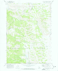
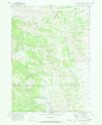
1968 Map of Jeff Cabin Creek
USGS Topo · Published 1973About this map
The historic Oregon Trail cuts a distinct path through this section of the Portneuf Range, offering a look at the travel corridors utilized in the late 1960s. The landscape is defined by its water sources and drainage systems, including Jeff Cabin Creek, Little Toponce Creek, and Fourth of July Creek. A significant administrative line, the Fort Hall Indian Reservation Boundary, bisects the southern half of the map, separating reservation lands from the Caribou National Forest.
Find a feature on this map
21 named features on this map. Tap any name to fly to it.
Don’t see what you’re looking for? This feature index may not catch every label — zoom into the map to look around manually.
Map Details
Editions of this 1968 Jeff Cabin Creek Map
2 editions found
Other maps of this area
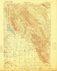
1917 · Portneuf
USGS Topo · 1:62,500
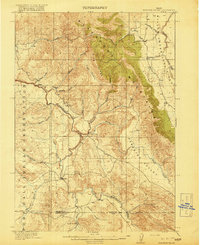
1918 · Paradise Valley
USGS Topo · 1:62,500

1954 · Pocatello
USGS Topo · 1:250,000

1955 · Yandell Springs
USGS Topo · 1:62,500

1955 · Idaho Falls
USGS Topo · 1:250,000

1955 · Driggs
USGS Topo · 1:250,000

1955 · Preston
USGS Topo · 1:250,000

1958 · Driggs
USGS Topo · 1:250,000

1958 · Idaho Falls
USGS Topo · 1:250,000

1958 · Pocatello
USGS Topo · 1:250,000