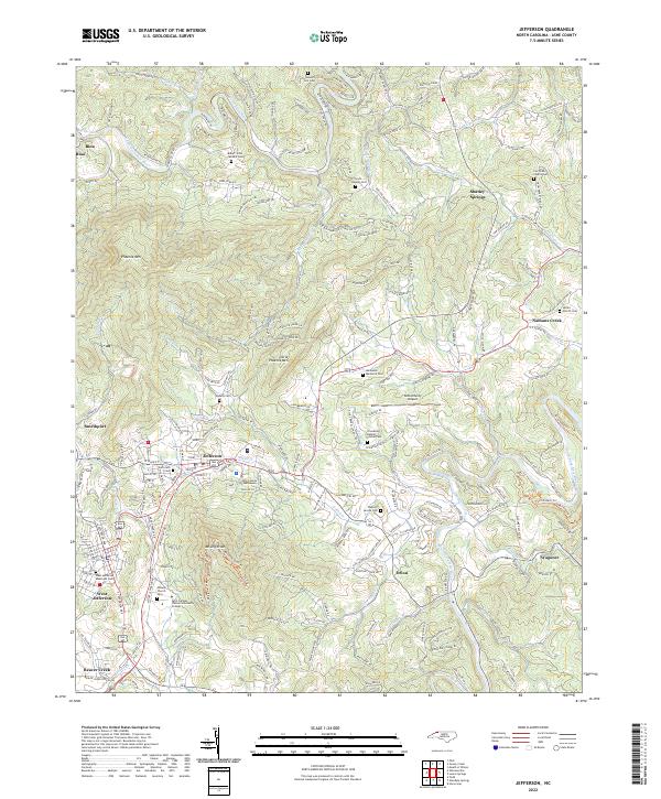
2022 Map of Jefferson
USGS Topo · Published 2022About this map
Jefferson and West Jefferson serve as the twin hubs of this mountain landscape, where the Ashe County Courthouse stands as a central civic landmark. The terrain is defined by the massive rise of Phoenix Mtn and Little Phoenix Mtn, while the North Fork New River and South Fork New River wind through the valleys. The map provides significant detail for genealogists, documenting numerous family and community burial grounds such as the Baker - Eller McNeil Cem, Scott - Blevins Cem, and the West Jefferson Municipal Cem.
Find a feature on this map
218 named features on this map. Tap any name to fly to it.
Don’t see what you’re looking for? This feature index may not catch every label — zoom into the map to look around manually.
Map Details
Editions of this 2022 Jefferson Map
This is the sole edition of this map. No revisions or reprints were ever made.
Other maps of this area

1889 · Wytheville
USGS Topo · 1:125,000

1889 · Wilkesboro
USGS Topo · 1:125,000

1891 · Abingdon
USGS Topo · 1:125,000

1891 · Wilkesboro
USGS Topo · 1:125,000

1892 · Wytheville
USGS Topo · 1:125,000

1893 · Cranberry
USGS Topo · 1:125,000

1894 · Abingdon
USGS Topo · 1:125,000

1895 · Cranberry
USGS Topo · 1:125,000

1899 · Cranberry
USGS Topo · 1:125,000

1902 · Cranberry
USGS Topo · 1:125,000