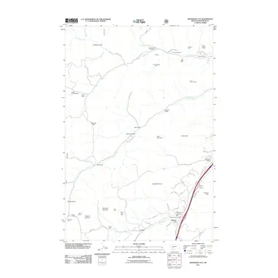
2011 Map of Jefferson City
USGS Topo · Published 2011About this map
Jefferson City and the neighboring settlement of Corbin serve as the primary hubs in this high-altitude landscape of Jefferson County. The terrain is defined by a dense network of gulches and peaks, including Gregory Mountain, Emerson Peak, and Blueball Mountain. Waterways such as Prickly Pear Creek and Clancy Creek cut through the topography, which is marked by an extensive legacy of resource extraction. The map reveals a high concentration of mining operations scattered across the mountain slopes, such as the Roosevelt Mine in the north and the Minnesota Mine to the west. This industrial footprint is integrated with modern infrastructure, including the Jefferson City Post Office and the Jefferson City Rest Area, while narrow roads like Lump Gulch Rd and Corbin Rd wind through the gulches to connect remote sites with the main thoroughfares.
Find a feature on this map
78 named features on this map. Tap any name to fly to it.
Don’t see what you’re looking for? This feature index may not catch every label — zoom into the map to look around manually.
Map Details
Editions of this 2011 Jefferson City Map
This is the sole edition of this map. No revisions or reprints were ever made.
Other maps of this area

1886 · Fort Logan
USGS Topo · 1:250,000

1889 · Helena
USGS Topo · 1:250,000

1893 · Helena
USGS Topo · 1:250,000

1899 · Boulder
USGS Topo · 1:125,000

1899 · Helena
USGS Topo · 1:62,500

1899 · Helena
USGS Topo · 1:250,000

1903 · Helena
USGS Topo · 1:250,000

1947 · Butte
USGS Topo · 1:250,000

1948 · White Sulphur Springs
USGS Topo · 1:250,000

1950 · Jefferson City
USGS Topo · 1:62,500