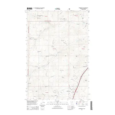
2014 Map of Jefferson City
USGS Topo · Published 2014About this map
Jefferson City and the neighboring settlement of Corbin occupy the mountain valleys south of the Helena National Forest in this 2014 survey. The landscape is defined by its deep gulches and high peaks, including Gregory Mountain and Valparaiso Mountain. Waterways like Prickly Pear Creek and Clancy Creek provide the primary drainage for the area, dictating the placement of early road networks such as Clancy Creek Road and Corbin Road. The presence of Powder House Road and names like McCauley Flats hint at the region's historic mining and land-use patterns, while higher elevations are marked by landmarks like Windy Butte and Emerson Peak. This modern topographic study preserves the naming conventions of the gulches—such as Browns Gulch and Lump Gulch—that have shaped the geography of Jefferson County for generations.
Find a feature on this map
75 named features on this map. Tap any name to fly to it.
Don’t see what you’re looking for? This feature index may not catch every label — zoom into the map to look around manually.
Map Details
Editions of this 2014 Jefferson City Map
This is the sole edition of this map. No revisions or reprints were ever made.
Other maps of this area

1886 · Fort Logan
USGS Topo · 1:250,000

1889 · Helena
USGS Topo · 1:250,000

1893 · Helena
USGS Topo · 1:250,000

1899 · Boulder
USGS Topo · 1:125,000

1899 · Helena
USGS Topo · 1:62,500

1899 · Helena
USGS Topo · 1:250,000

1903 · Helena
USGS Topo · 1:250,000

1947 · Butte
USGS Topo · 1:250,000

1948 · White Sulphur Springs
USGS Topo · 1:250,000

1950 · Jefferson City
USGS Topo · 1:62,500