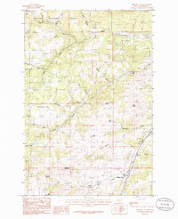
1985 Map of Jefferson City
USGS Topo · Published 1986About this map
Jefferson City and the small settlement of Corbin are situated in a landscape defined by its mining heritage and rugged terrain within the Helena National Forest. By the mid-1980s, the industrial footprint of the region is evidenced by numerous Mine Shafts and prospects dotting the slopes of peaks like Valparaiso Mountain and Gregory Mountain. An Abandoned R. R. follows the path of Prickly Pear Creek, tracing the former transportation corridor that once served the local extraction economy. The map reveals a complex network of 4WD trails and gulches, including Clancy Creek and Lump Gulch, which carved through the high country. For genealogists and local historians, the inclusion of the Cem near Jefferson City and distinctive landmarks like Mc Cauley Flats and Windy Butte provides a precise look at the area's rural character during the late 20th century.
Find a feature on this map
35 named features on this map. Tap any name to fly to it.
Don’t see what you’re looking for? This feature index may not catch every label — zoom into the map to look around manually.
Map Details
Editions of this 1985 Jefferson City Map
This is the sole edition of this map. No revisions or reprints were ever made.
Other maps of this area

1886 · Fort Logan
USGS Topo · 1:250,000

1889 · Helena
USGS Topo · 1:250,000

1893 · Helena
USGS Topo · 1:250,000

1899 · Boulder
USGS Topo · 1:125,000

1899 · Helena
USGS Topo · 1:62,500

1899 · Helena
USGS Topo · 1:250,000

1903 · Helena
USGS Topo · 1:250,000

1947 · Butte
USGS Topo · 1:250,000

1948 · White Sulphur Springs
USGS Topo · 1:250,000

1950 · Jefferson City
USGS Topo · 1:62,500