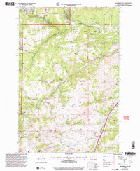
2001 Map of Jefferson City
USGS Topo · Published 2004About this map
Jefferson City and the nearby settlement of Corbin are the primary hubs in this mountainous reach of the Helena National Forest during the late 20th century. The landscape is heavily marked by its mineral history, with numerous extraction sites such as the Free Coinage Mine to the north and the Gregory Mine to the south. These operations, along with numerous unnamed Mine Shafts and Tailings piles along Clancy Creek, define the industrial character of the gulches and peaks.
Find a feature on this map
40 named features on this map. Tap any name to fly to it.
Don’t see what you’re looking for? This feature index may not catch every label — zoom into the map to look around manually.
Map Details
Editions of this 2001 Jefferson City Map
This is the sole edition of this map. No revisions or reprints were ever made.
Other maps of this area

1886 · Fort Logan
USGS Topo · 1:250,000

1889 · Helena
USGS Topo · 1:250,000

1893 · Helena
USGS Topo · 1:250,000

1899 · Boulder
USGS Topo · 1:125,000

1899 · Helena
USGS Topo · 1:62,500

1899 · Helena
USGS Topo · 1:250,000

1903 · Helena
USGS Topo · 1:250,000

1947 · Butte
USGS Topo · 1:250,000

1948 · White Sulphur Springs
USGS Topo · 1:250,000

1950 · Jefferson City
USGS Topo · 1:62,500